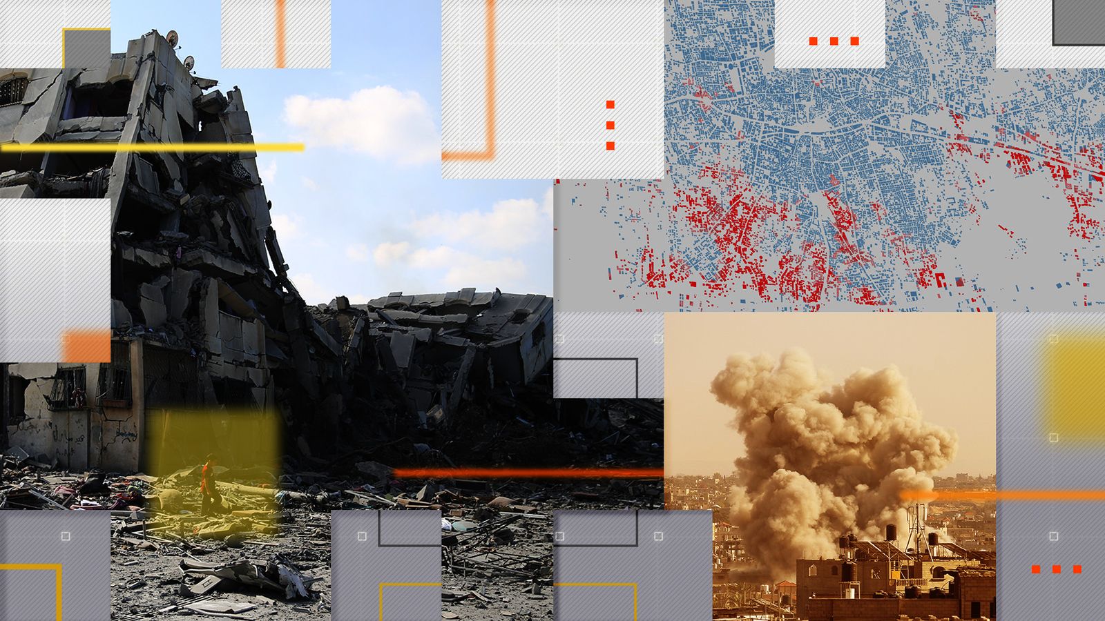
For three weeks, Israel has been bombing the Gaza Strip as part of its war with Hamas.
The two sides have published conflicting accounts of the toll taken by the airstrikes. Satellite data gives us an independent view.
Every 12 days, NASA’s Sentinel-1 satellite passes three times over the Gaza Strip, firing out radar waves and listening for their echo. Buildings typically bounce the signals right back, but rubble scatters them in all directions.
By comparing signals before the war with those taken more recently, we can estimate the scope and scale of the destruction.
This map shows what Gaza looked like before the war, its population densely clustered in Gaza City, in the far north, and the southern cities of Rafah and Khan Younis.
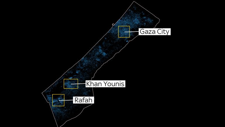
Map of buildings in the Gaza Strip, with major cities highlighted. SOURCE: Open Street Map
By 13 October, six days after Hamas launched its attacks in southern Israel, much of Gaza City had been hit by airstrikes.
The satellite data suggests 15% of buildings in northern Gaza were damaged or destroyed in less than a week, along with 2% in southern Gaza.
That same day, Israel ordered all 1.1 million residents of northern Gaza to flee southwards to relative safety.
Since then, however, Israel has stepped up its bombing of the south.
The map below shows the estimated damage to buildings across Gaza on 13 and 25 October, with the most damaged areas highlighted in yellow.
Almost half of all new damage detected between 14 and 25 October was in southern Gaza (47%), up from 14% before the evacuation order.
While there was a decrease in new damage across the Gaza Strip during those two weeks, the level of destruction in southern Gaza increased by 85%.
A spokesperson for the Israeli Defence Forces declined to comment.
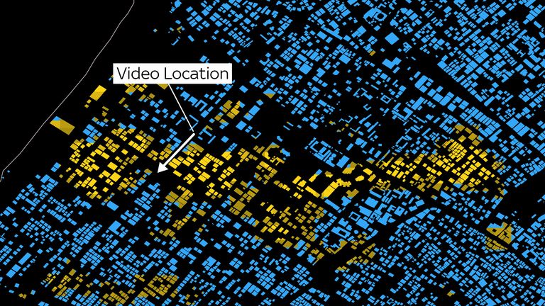
Many of those who fled the north after 13 October have ended up in the Gaza Strip’s second most populous city, Khan Younis.
Since then, satellite data shows neighbourhoods across the city have sustained damage.
The video below, uploaded to Snapchat on 24 October, shows smoke rising from behind a school in Khan Younis.
Sky News has verified the location of the footage, and satellite analysis shows that a row of buildings immediately behind the school sustained damage between 14 and 25 October.
The Gaza Strip has been under aerial bombardment since Hamas’s 7 October attack, in which the Israeli government says more than 1,400 were killed.
Israel says that Hamas is still holding more than 200 people hostage inside the enclave. Five British citizens remain missing.
The airstrikes come as Israel prepares to launch an anticipated ground invasion of the Gaza Strip.
According to Gaza’s health ministry, which is controlled by Hamas, more than 6,500 people have been killed in the airstrikes – two-thirds of them women and children.
Sky’s satellite data suggests that one in four buildings in northern Gaza (25%) have been damaged or destroyed in the past three weeks, along with 8% of those in the south.
The Rimal neighbourhood of Gaza City has been hit particularly hard.
This video below, uploaded to Snapchat on 20 October and verified by Sky News, shows the local high street in ruins.
From the satellite analysis, we can see that the video shows just a small part of the destruction in Rimal.
Map of estimated damage to buildings in Rimal, Gaza Strip, 25 October. SOURCE: NASA/Open Street Maps
Sky’s analysis of satellite data followed a method developed by academics and promoted by NASA.
This is a conservative estimate – Sky News has only classified an area as damaged if the satellite records at least a 30% decrease in surface smoothness over a 1,600 square metre area.
Damage to a single building, or even its total destruction, is unlikely to reach that threshold. Damage to the side of buildings may not be detected at all.
The Gaza Ministry of Public Works says that 27,781 housing units, or around 7% of the total, have been destroyed or rendered uninhabitable since 7 October.
Additional reporting by Sanya Burgess
The Data and Forensics team is a multi-skilled unit dedicated to providing transparent journalism from Sky News. We gather, analyse and visualise data to tell data-driven stories. We combine traditional reporting skills with advanced analysis of satellite images, social media and other open source information. Through multimedia storytelling we aim to better explain the world while also showing how our journalism is done.